
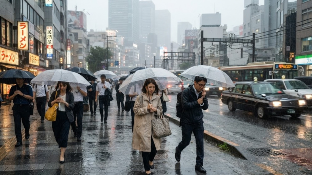
The Typhoon Dujuan Tokyo threat is now at its sharpest. Japan’s 25th named storm of the year is moving up the Pacific side of the country, and the capital region is bracing for a very wet Monday night. Heavy rain has already soaked the Izu Islands and parts of Chiba. In response, forecasters have placed the town of Oshima under the highest-level landslide warning.
What the Typhoon Dujuan Tokyo Warnings Mean
The Japan Meteorological Agency (JMA) has issued a Level 5 landslide warning for the northern Izu Islands, the top tier of Japan’s five-step alert scale. Oshima sits about 110 km south of Tokyo. Other parts of the Kanto region are under Level 4 warnings covering heavy rain, landslides and flooding.
The rainfall totals explain the concern. In the 24 hours to 7:40 a.m. Monday, Izu Oshima recorded 387.5 mm, and the city of Kimitsu in Chiba received 283.5 mm, according to figures reported by The Japan Times. The Japan Meteorological Agency has forecast up to 300 mm more across Kanto and the Izu Islands by 7 a.m. Tuesday. It has also said that totals through Tuesday could surpass a normal September’s entire rainfall, which it described as potentially record-breaking. The agency further warned that narrow, intense bands of rain could develop over Kanto and central Japan, which can trigger flash flooding with little notice.
At 7:45 a.m. Monday the typhoon was about 180 km south of Hachijojima, moving north-northeast at 20 km/h. Its central pressure was 965 hPa, with sustained winds of 35 m/s (126 km/h) and gusts up to 50 m/s.
One death confirmed, hundreds of flights grounded
The Fire and Disaster Management Agency reported one confirmed death and one minor injury in Miyazaki Prefecture in its Monday-afternoon update. That is the official count as of that report, and it may change as the storm passes. In Chiba, more than 4,000 households lost electricity.
Air travel took the biggest hit. Japan Airlines scrapped 120 domestic and 15 international services, and All Nippon Airways cancelled 140 domestic flights, bringing the total to at least 275 cancellations. JR East fully suspended the Kururi Line in Chiba and halted sections of several other lines in Chiba, Ibaraki and western Tokyo. The Tokyo Game Show dropped its Monday program, Ueno Zoo and the Kasai Rinkai Aquarium closed, and Asian Games organisers in Aichi moved the equestrian eventing competition to Tuesday.
A storm that landed on a holiday weekend
The timing makes matters harder. Silver Week, a run of public holidays lasting through Wednesday, normally sends large numbers of people onto planes and trains. This time it means crowded transport hubs and a lot of visitors and holidaymakers away from home just as conditions worsen.
Flood-related emergencies are also a live issue elsewhere in Asia. Readers following that wider picture can look at HCN’s earlier report on Nepal’s flood response and climate compensation debate.
What to expect next
According to the JMA, the storm is expected to reach the Izu Islands and Kanto between Monday afternoon and early Tuesday morning. It should pass near the Boso Peninsula in Chiba from Monday evening into late night, then head east off the Tohoku coast. Forecast totals by Tuesday morning are up to 350 mm in Tokai and up to 200 mm in Tohoku.
For city residents, the agency cautioned that roads may flood. It advised staying out of underground spaces, where water can collect quickly and vehicles can be trapped. Travellers should confirm flight and rail status directly with their carrier, since cancellations are being updated through the day. As the Typhoon Dujuan Tokyo situation develops, casualty and damage figures will be updated once authorities release confirmed numbers.